Misc
Mapped: The Drainage Basins of the World’s Longest Rivers
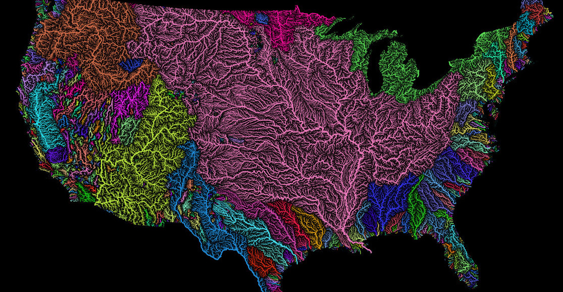
View the full-size version of this infographic.
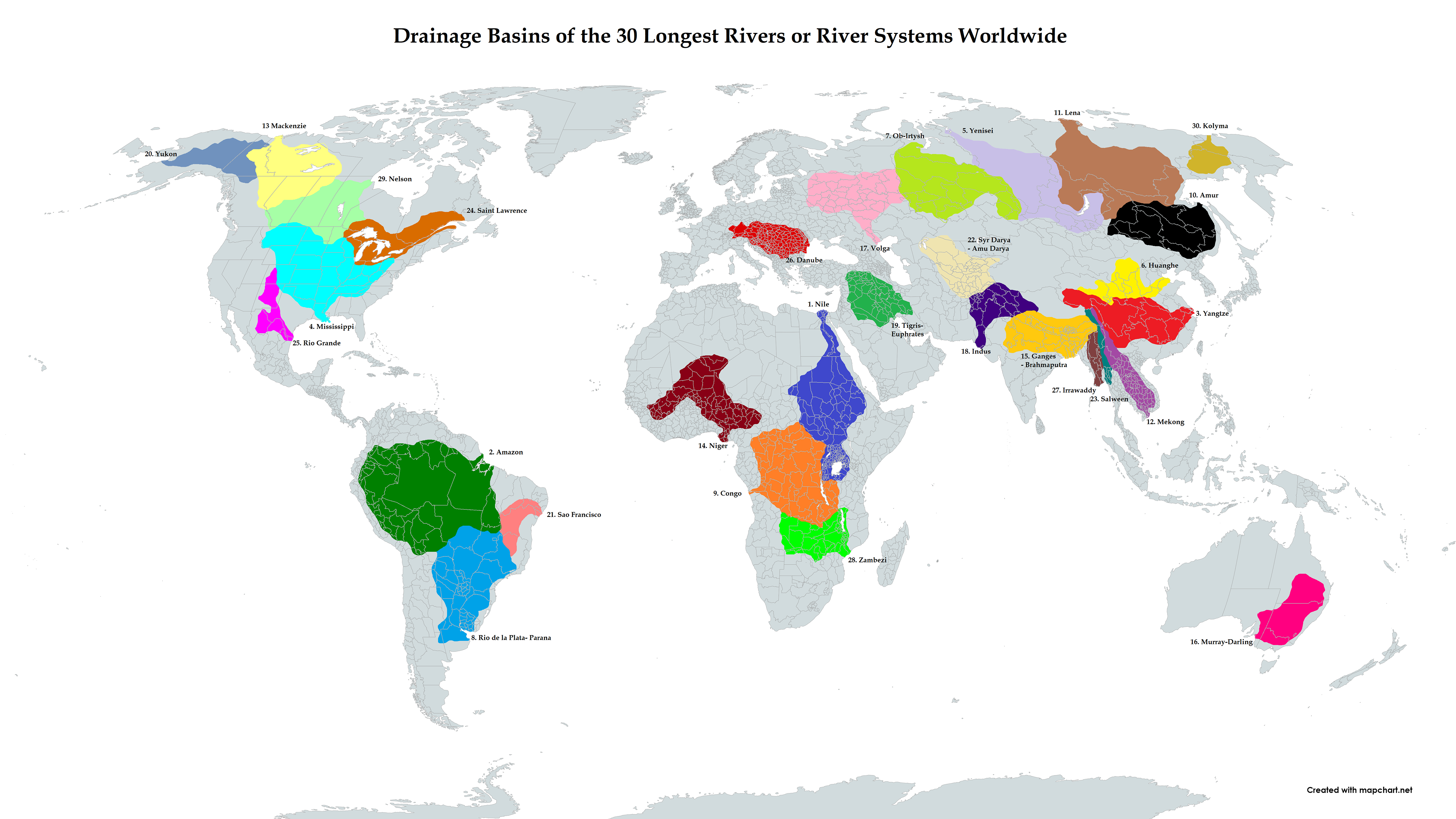
Drainage Basins of the World’s Longest Rivers
Most of the earth’s surface is covered in water, but less than 1% of it is the fresh water that makes up the rivers and lakes we’re familiar with.
The water we encounter in life is moving through the stages of the water cycle. And even though rivers make up a tiny portion of all fresh water, they’re still one of the most visible parts of that cycle, especially for the billions of people who live in cities and towns built alongside them.
Of course, rivers don’t just appear out of nowhere. They’re the end result of water’s land-based journey–the product of many compounding inflows collected within a drainage basin.
The map above, from Reddit user r/CountZapolai, illustrates how massive the drainage basins can be for the world’s longest rivers.
What is a Drainage Basin?
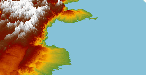
A river’s drainage basin is defined as the area of land where precipitation collects and drains off, feeding the flow of rivers and their tributaries. Simply put, this is the process of water draining from higher points of land to lower laying areas–as demonstrated by the animation below.
In the case the world’s longest rivers, these drainage basins can span across entire continents and cross many international borders.
Fueling the World’s Longest Rivers
The longer a river system gets, the more terrain it passes through. It comes as no surprise then that the longest rivers are supported by immense drainage basins.
Here are the world’s top 10 longest rivers, and the size of their respective basins:
| Rank | River system | Length in miles (km) | Drainage area in miles² (km²) | Outflow | Countries in basin |
|---|---|---|---|---|---|
| 1 | Nile | 4,130 (6,650) | 1,256,591 (3,254,555) | Mediterranean | 🇪🇹🇪🇷🇸🇩🇺🇬🇹🇿🇰🇪🇷🇼🇧🇮🇪🇬🇨🇩🇸🇸 |
| 2 | Amazon | 3,976 (6,400) | 2,702,715 (7,000,000) | Atlantic Ocean | 🇧🇷🇵🇪🇧🇴🇨🇴🇪🇨🇻🇪🇬🇾 |
| 3 | Yangtze | 3,917 (6,300) | 694,984 (1,800,000) | East China Sea | 🇨🇳 |
| 4 | Mississippi | 3,902 (6,275) | 1,150,584 (2,980,000) | Gulf of Mexico | 🇺🇸🇨🇦 |
| 5 | Yenisei | 3,445 (5,539) | 996,143 (2,580,000) | Kara Sea | 🇷🇺🇲🇳 |
| 6 | Huang He (Yellow River) | 3,395 (5,464) | 287,646 (745,000) | Bohai Sea | 🇨🇳 |
| 7 | Ob–Irtysh | 3,364 (5,410) | 1,154,445 (2,990,000) | Gulf of Ob | 🇷🇺🇰🇿🇨🇳🇲🇳 |
| 8 | Río de la Plata | 3,030 (4,880) | 997,175 (2,582,672) | Río de la Plata | 🇧🇷🇦🇷🇵🇾🇧🇴🇺🇾 |
| 9 | Congo | 2,922 (4,700) | 1,420,856 (3,680,000) | Atlantic Ocean | 🇨🇩🇨🇫🇦🇴🇨🇩🇹🇿🇨🇲🇿🇲🇧🇮🇷🇼 |
| 10 | Amur | 2,763 (4,444) | 716,220 (1,855,000) | Sea of Okhotsk | 🇷🇺🇨🇳🇲🇳 |
Note: There is debate about the actual length of certain river systems. See a more comprehensive range of estimates here.
These 10 longest rivers alone are fed by a land area equivalent to the size of Africa.
Of those, the Amazon Basin is the largest in the world by far, covering one-third of the South American continent.
River Drainage Basins and Humanity
The fact that huge population centers sit at the terminuses of many of these key rivers is a testament to how important watersheds are to our survival. Only 10% of the global population lives further than six miles away from a surface freshwater body, and more often than not, that fresh water comes in the form of a river.
Noting where rivers begin their journey is also important as well. In the case of Tibet, many of the world’s longest rivers are fed by drainage basins that begin in the region. In fact, six of Asia’s major rivers begin on the Tibetan Plateau, meeting the basic needs of billions of people.
By illustrating the world’s longest rivers and their drainage basins, maps like this one help put into perspective the breathtaking complexity of Earth’s hydrological cycle.

VC+
VC+: Get Our Key Takeaways From the IMF’s World Economic Outlook
A sneak preview of the exclusive VC+ Special Dispatch—your shortcut to understanding IMF’s World Economic Outlook report.

Have you read IMF’s latest World Economic Outlook yet? At a daunting 202 pages, we don’t blame you if it’s still on your to-do list.
But don’t worry, you don’t need to read the whole April release, because we’ve already done the hard work for you.
To save you time and effort, the Visual Capitalist team has compiled a visual analysis of everything you need to know from the report—and our VC+ Special Dispatch is available exclusively to VC+ members. All you need to do is log into the VC+ Archive.
If you’re not already subscribed to VC+, make sure you sign up now to access the full analysis of the IMF report, and more (we release similar deep dives every week).
For now, here’s what VC+ members get to see.
Your Shortcut to Understanding IMF’s World Economic Outlook
With long and short-term growth prospects declining for many countries around the world, this Special Dispatch offers a visual analysis of the key figures and takeaways from the IMF’s report including:
- The global decline in economic growth forecasts
- Real GDP growth and inflation forecasts for major nations in 2024
- When interest rate cuts will happen and interest rate forecasts
- How debt-to-GDP ratios have changed since 2000
- And much more!

Get the Full Breakdown in the Next VC+ Special Dispatch
VC+ members can access the full Special Dispatch by logging into the VC+ Archive, where you can also check out previous releases.
Make sure you join VC+ now to see exclusive charts and the full analysis of key takeaways from IMF’s World Economic Outlook.
Don’t miss out. Become a VC+ member today.
What You Get When You Become a VC+ Member
VC+ is Visual Capitalist’s premium subscription. As a member, you’ll get the following:
- Special Dispatches: Deep dive visual briefings on crucial reports and global trends
- Markets This Month: A snappy summary of the state of the markets and what to look out for
- The Trendline: Weekly curation of the best visualizations from across the globe
- Global Forecast Series: Our flagship annual report that covers everything you need to know related to the economy, markets, geopolitics, and the latest tech trends
- VC+ Archive: Hundreds of previously released VC+ briefings and reports that you’ve been missing out on, all in one dedicated hub
You can get all of the above, and more, by joining VC+ today.

-

 Energy1 week ago
The World’s Biggest Nuclear Energy Producers
-

 Money2 weeks ago
Which States Have the Highest Minimum Wage in America?
-

 Technology2 weeks ago
Ranked: Semiconductor Companies by Industry Revenue Share
-

 Markets2 weeks ago
Ranked: The World’s Top Flight Routes, by Revenue
-

 Countries2 weeks ago
Population Projections: The World’s 6 Largest Countries in 2075
-

 Markets2 weeks ago
The Top 10 States by Real GDP Growth in 2023
-

 Demographics2 weeks ago
The Smallest Gender Wage Gaps in OECD Countries
-

 United States2 weeks ago
Where U.S. Inflation Hit the Hardest in March 2024