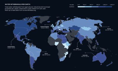

How much water do we have, and which countries use the most? This visual breaks down global water distribution and withdrawals by countries.
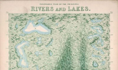

Rivers and lakes have played important roles throughout history. This Vintage Viz looks at these bodies of water from the viewpoint of 1850.
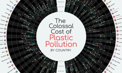

The environmental impact of the combined 139M tons of plastic pollution in oceans and rivers is well known, but what about the economic cost?
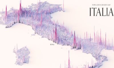

These maps show the population density of several countries, using 3D spikes to denote where more people live.

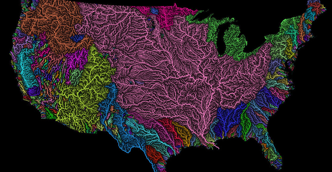
Where does each river start, converge, and end? This series of maps traces river basins in each continent around the world.
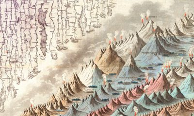

This iconic infographic map is an early and ambitious attempt to compare the world's tallest mountains and longest rivers.
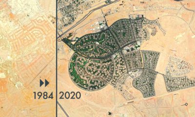

From rapid urbanization to retreating glaciers, these timelapsed satellite maps capture the drastic changes the Earth's surface has undergone.
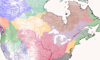
Nothing is more fundamental to life than water - so see the world's watersheds like never before with these colorful and absolutely stunning maps.


 Creator Program