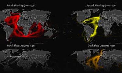

This map plots the colonial shipping lanes used by the British, the French, the Spanish, and the Dutch in the 18th and 19th centuries.
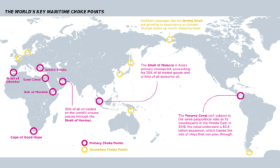

Ocean shipping is the primary mode of international trade. This map identifies maritime choke points that pose a risk to this complex logistic network.


 Creator Program