

China has grown its nuclear capacity over the last decade, now ranking second on the list of top nuclear energy producers.
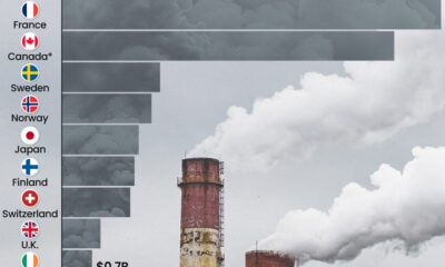

This graphic highlights France and Canada as the global leaders when it comes to generating carbon tax revenue.
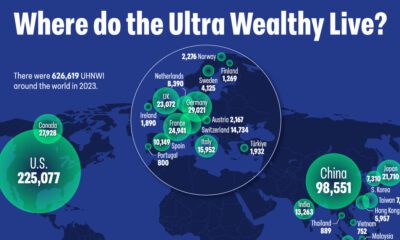

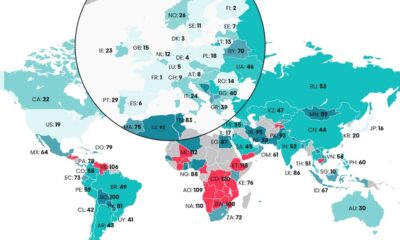
There are over 600,000 individuals worldwide with a net worth surpassing $30 million, representing the wealthiest people on the planet. Here's where they live.
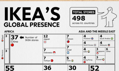

Known for their size, labyrinth-like layouts, food, and of course, functional furniture, IKEA stores have become a whole shopping experience. But which country has the most...
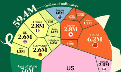

Nearly half of global household wealth is held by those with more than $1 million. But where in the world do the wealthiest people live?

The Digital Quality of Life Index shows which countries are doing a better job than others in providing accessible and affordable internet.
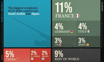

The U.S. is the biggest weapons exporter in the world, but which other countries take up a significant share of global arms exports in 2022? And...
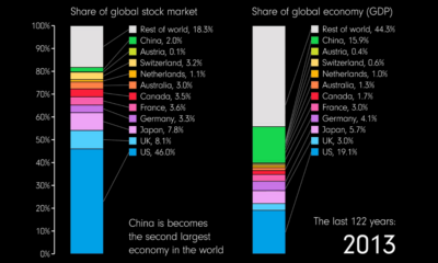

This animation compares countries' share of the global stock market and GDP over 122 years from 1900 to 2022.
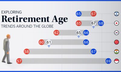

We chart current and effective retirement ages for 45 countries, revealing some stark regional differences.
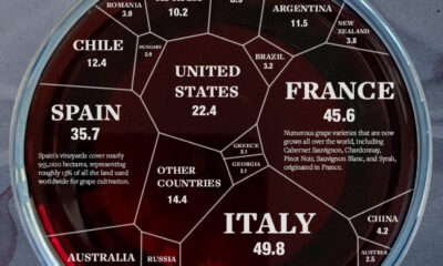

We break down the major wine producers of the world by country and how much they contribute to world wine supply.


 Creator Program