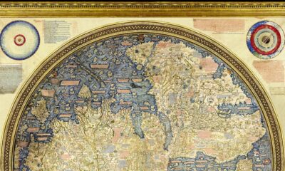

Check out the Fra Mauro Mappa Mundi (c. 1450s), a historical map that formed a bridge between medieval and renaissance worldviews.
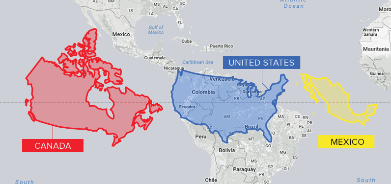
Conventional cartographic techniques have caused many to have a skewed perception of the true size of countries. Can an equal-area map provide clarity?
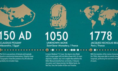

What did ancient maps look like, before we had access to airplanes and satellites? See the evolution of the world map in this nifty infographic.


